
 Full list of equipped paths
  Via ferrata
 Equipped path
 Equipped section
 Equipped canyon
 Via cordata
 Via cable
 Trails
 Bike routes
 Blog
Blog All photos
 Mountain guides
Badlands | Notch Trail
Short walk between the canyons and tall sandstone formations in one of the most accessible trails of the Badlands nature park.

Beginning of Notch Trail




Location
InteriorJacksonSouth DakotaE.E.U.U. Technical description Duration
 1 h.
 Difficulty
 1/5
 Level difference
 106 m.
 Length
 2,6 Km.
 Signposted
 Sí
 Route status
 3/5
 Type
Type Tierra
 Round-trip
 No
 Season
How to get there
» Rapid City is the closest village to the entrance of the park next to the Interstate 90. In Cactus Flat we took highway 240 that will take us to the visitors center- entrance fee of $15 per vehicle- starting point for several pathways.
» If we do not want to walk we can continue by car via highway 240 - Badlands Loop, a Scenic Road that will give us a general vision of the park.
The route
The Badlands are surrounded by other parks that are more renowned, such as Black Hills & Mt. Rushmore, for which it is not the primary destination for outdoor activity lovers and goes somewhat unnoticed in the enormousness of South Dakota.
However, if we find it on the way it deserves a visit, the well signaled trails introduce us to what seems like a labyrinth of delicate sandstone formations. As well, even though it seems strange, there are wild animals, including the terrible rattlesnakes and the nicer prairie dogs that we will see continuously, thankfully not like the aforementioned.
Panoramic picture of the ledge / Badlands
If we dispose of little time, as it was in our case, it is possible to go through 2 mini trails and the familiar Notch Trail in less than 2 hours. This is part of one of the sections with more formations of the park.
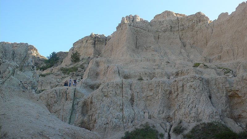
Going through a narrow canyon we will arrive to an amphitheater with a single exit, an equipped angled stairway that will allow us to reach a higher balcony. The balcony ledge -watch out that it is narrow- will take us to the end of the marked trail, an extensive viewpoint to the meadows south of Badlands.
It is a short experience but interesting due to the particularities and the originality of the terrain.
Recommendations: it is important to not wander out of the marked trail, the terrain is unstable and hides more dangers than it can appear, especially in the case of a storm.
Visiting Badlands during the afternoon or at sunrise is the best choice.
Note
The Lakota named the place as “Mako Sica,” which translates to “Bad lands” or “Useless lands.” It seems like they were in agreement with the French voyageurs from the first years of the XIX century who named them “Mauvaises Terres a Traverser”, the “Bad lands to cross.”
Source: Hiking the Black Hills.


